The rynda.io Ports Map is a live map of vessels and ports with a cargo marketplace laid over it. It shows not only where ships are right now and what they're doing, but which cargo and open tonnage are nearby — with a one-click path into a deal. That's what sets the rynda.io map apart from a plain tracker.
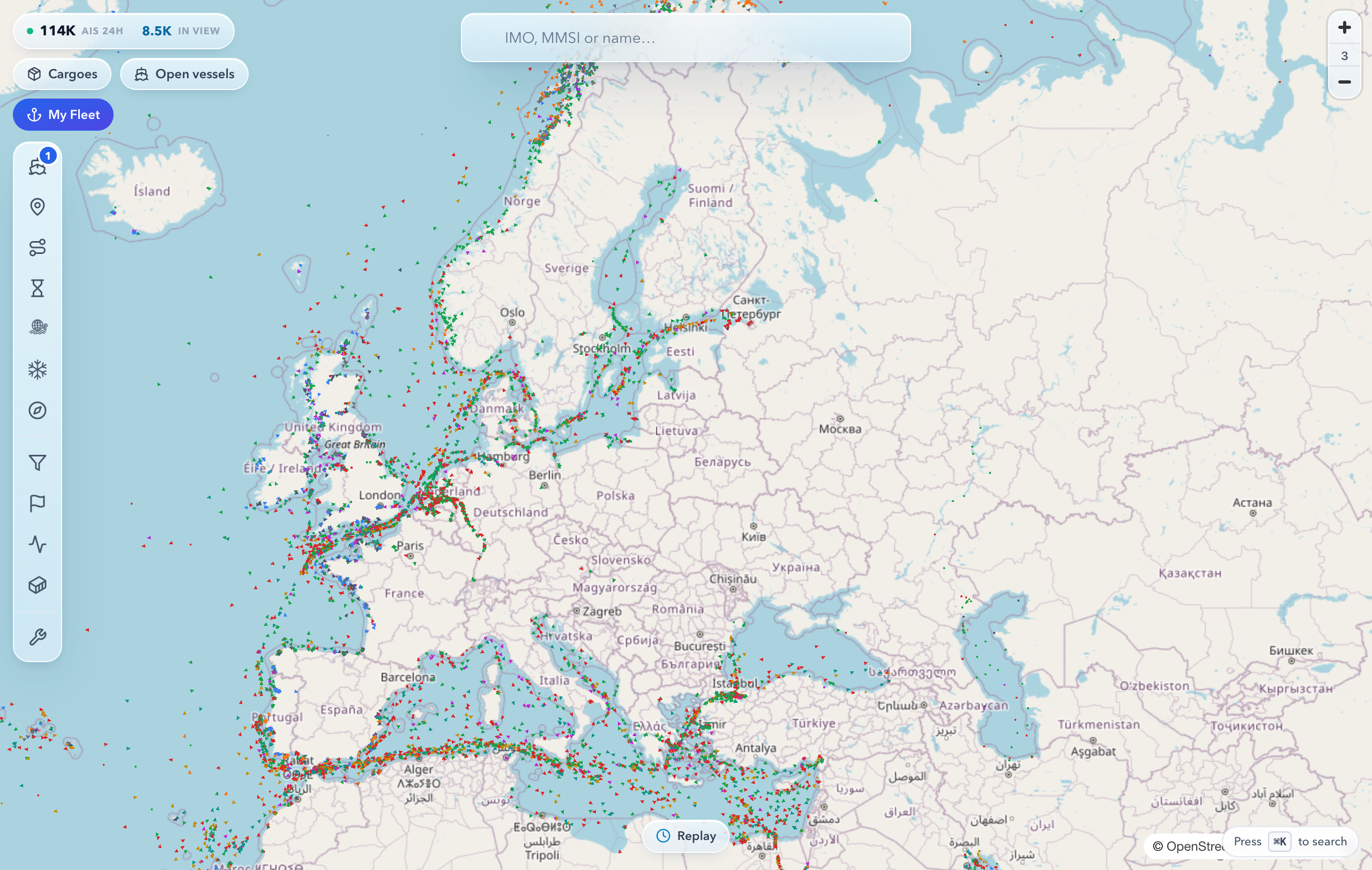
What you see on the map
- Live vessels with filters by type and motion status.
- Ports — a directory with NGA World Port Index particulars and live traffic in port.
- Layers — recent trails, planned routes, weather, sea ice, NSR zones, ECA/SECA zones.
- Open tonnage (For Orders) — vessels looking for cargo.
- Cargo nearby — compatible cargo from the marketplace.
How to use the map
- Find a vessel or port via search.
- Click a vessel — a card opens with its position and details.
- Turn on the filters you need: vessel type, status, sanctions.
- Add layers: trails, ECA zones, the port directory.
- Build a route in the planner, or select a vessel and use Replay to rewind its path.
What the vessel card shows
The card opens when you click a vessel. Position, course and speed, type, flag and dimensions are visible to everyone. The rest depends on sign-in and plan — the same way as on the vessel page:
- Signed out — the PSC inspection summary and the sanctions verdict; the names of the owner, operator and class society are hidden. The "Compliance & Risk", "Classification", "Safety management", "Trading areas" and "History" sections are locked and open after sign-up.
- FREE — every section. Trading areas cover the last 12 months and inspections the five most recent. Ownership history, earlier months and the full inspection history carry a button with a PRO tag that leads to the plans.
- PRO and Enterprise — plus ownership history and up to ten inspections. The full inspection history and trading areas month by month for all years are on the vessel page.
Once your free vessel checks are used up, the card looks as it does signed out until the limit resets. What the inspections section shows is covered in PSC inspections.
Map tools
- Route planner — with the option to exclude straits and canals.
- Replay (time-travel) — play back the selected vessel's recent path through its AIS fixes.
- Zones — areas you draw on the map in your account, under Fleet → Zones; alerts when a vessel enters or leaves a zone work on PRO and ENTERPRISE.
Why does the map say "Live updates paused"?
The map refreshes vessel positions on its own while you are working with it. If the tab stays hidden for over a minute or you leave the map untouched for 15 minutes, refreshing stops — positions freeze on the last data and a "Live updates paused" notice appears at the top. Any action — moving the mouse, touching the screen, returning to the tab, or the "Resume" button — restarts updates immediately and pulls fresh positions.
Why did one vessel stop updating?
That is the daily measure on live watching. Without an account you can follow one vessel for 30 minutes; after that its card reads "Updates for this vessel are paused" and its position freezes — that vessel only. The map, search, ports, distance measuring and every other vessel keep working.
A free account lifts the limit. It also solves the underlying problem: instead of keeping a tab open, add the vessel to My Fleet and get a port-arrival alert by email or Telegram — no need to watch the map at all.
With an account the measure is still counted per vessel: one hour a day on FREE, three hours on PRO, no limit on ENTERPRISE. When a vessel’s time is up, only that vessel refreshes less often — every 12 hours on FREE or hourly on PRO; the rest of the map works as before.
The map is the core of rynda.io: the starting point for finding both a vessel and a cargo.
See also