The Sea ice layer is a maritime-map layer on rynda.io that shades waters by sea-ice concentration. It shows where the water is open, where the ice is sparse or close, and where fast ice sits along the coast — based on official ice charts from national ice services.
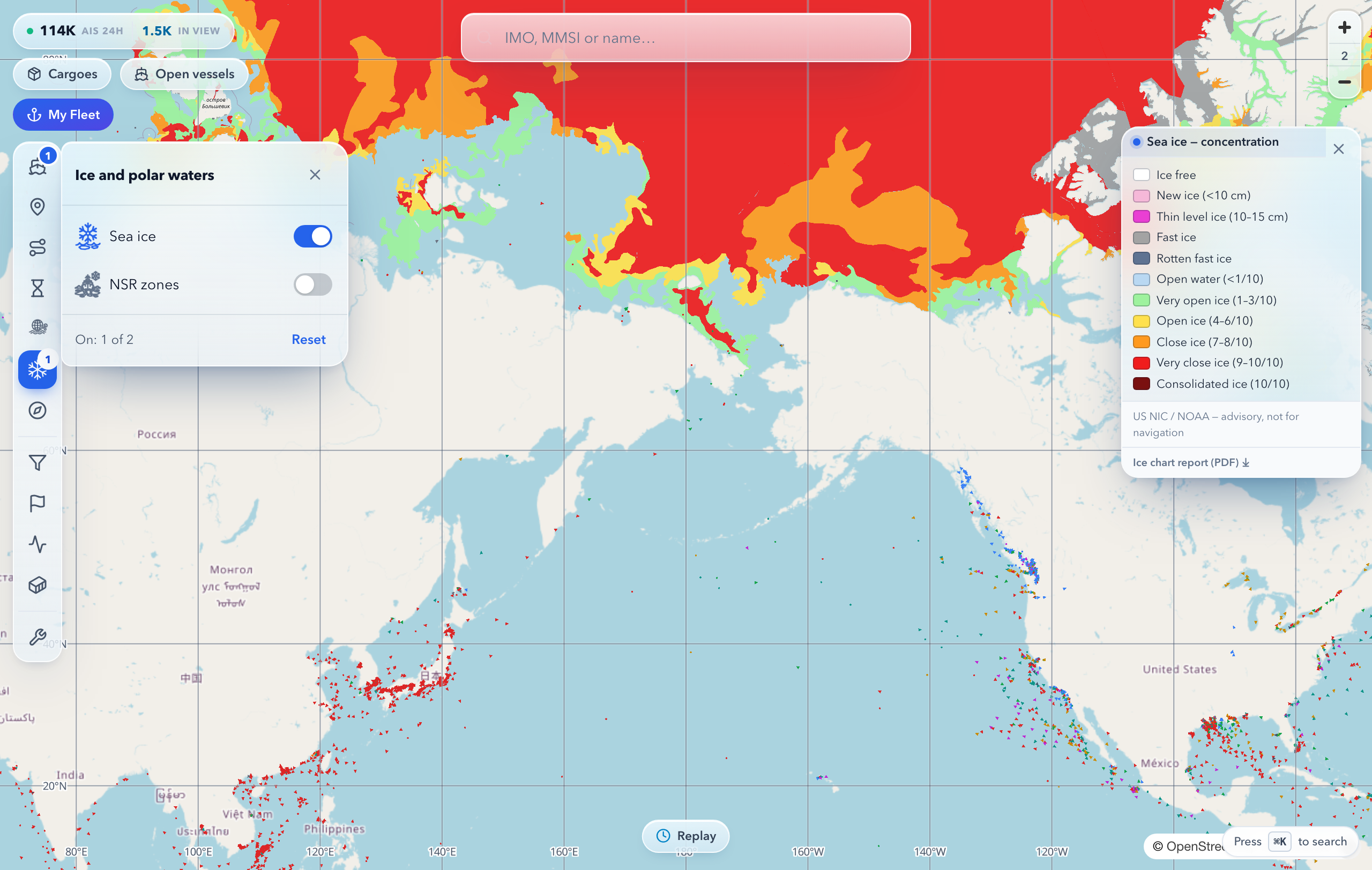
The fill colour corresponds to an ice class — from open water to consolidated ice:
| Class | Meaning |
|---|---|
| Ice-free, open water | no ice or less than 1/10 |
| New and thin ice | ice up to 15 cm thick |
| Open ice (1–6/10) | navigable, depending on the vessel's ice class |
| Close ice (7–10/10) | movement without icebreaker support is limited |
| Fast ice | immobile ice attached to the shore |
The exact colour legend opens with the layer on the right side of the map. Each chart's source and date are shown in the legend and in the popup — click the ice to see the class, source and date for a specific spot.
The layer legend has a report download button — it packs the ice picture into a document you can attach to voyage planning or forward to colleagues.
Ice + NSR zones + weather on one map — the picture for an Arctic passage comes together without switching between services.
