Map layers toggle different data on top of the map — from live vessels and trails to weather, ice and ECA/SECA zones. Layers are grouped by theme: one button in the left rail opens a panel with all of that group's toggles.
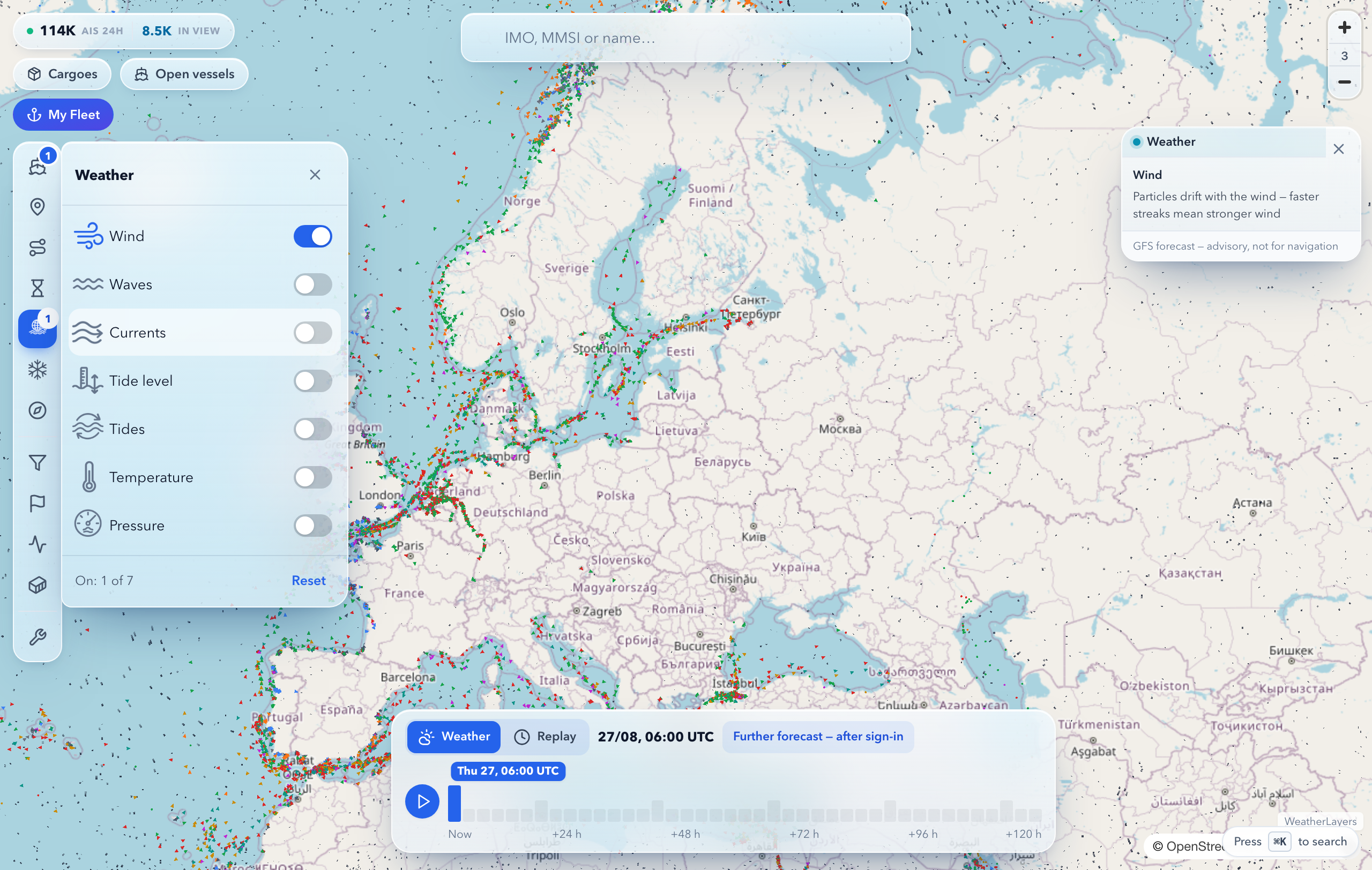
Which layer groups exist
| Group |
Layers inside |
| Vessels |
live AIS positions, Sanctioned, trails, traffic density; on the fleet map in your account, also My fleet only |
| Weather |
wind, waves, currents, tide level, tidal currents, temperature, pressure |
| Ice and polar waters |
sea ice, NSR zones |
| Navigational environment |
ECA / SECA zones |
| Tools |
Measure (ruler), Grid |
How to turn a layer on
- Open the Maritime Map.
- In the left rail, press a group icon — a column with toggles opens next to it.
- Switch on the layers you need — they combine: for example, vessels + wind + ice.
- The "Reset" button at the bottom of the column turns off all of the group's layers at once.
The number on a group icon shows how many of its layers are currently on — visible without opening the panel. The column can be moved anywhere on screen: double-click picks the panel up, a click drops it, double-clicking the title returns it to its default spot.
The legend of an active layer — weather, ice, NSR zones — has a close cross: the card hides while the layer stays on the map. Switch the layer off and on again and the legend returns.
Where layers live on the phone
On the phone the rail is replaced by the "Layers" button in the bottom bar: the first screen lists the groups with counters, tapping one opens that group's layers. The vessel filters — type, flag, status, Sanctioned — sit under Vessel filters in the More menu of the same bar.
Turn off layers you don't need if the map gets busy — keep only what the task requires.
See also