Port categories is a filter in the port display menu on the map that highlights ports in geographic zones with challenging ice conditions.
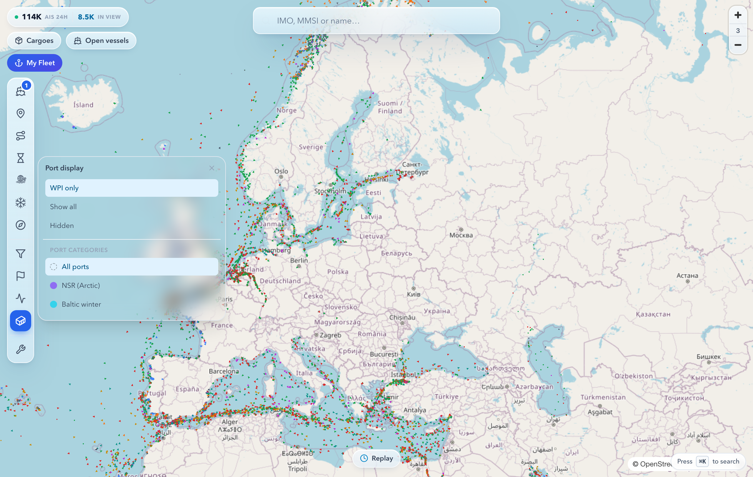
Three options are available:
- All — every port is shown without highlighting;
- NSR Arctic — ports along the Northern Sea Route and the surrounding Arctic (the NSR is the shipping route along Russia's northern coast);
- Winter Baltic — Baltic ports that freeze in winter and operate with icebreaker assistance.
The selected category highlights the relevant ports with coloured halos — soft glowing rings around the berth icon. This makes freezing and Arctic ports easy to spot on a busy map.
Why it helps
When the map is crowded with ports, it is hard to tell at a glance which ones need attention to the ice situation. The filter solves this:
- quickly find Arctic ports along the Northern Sea Route;
- separate freezing Baltic ports from ice-free ones;
- plan voyages with the season and ice limitations in mind at an early stage.
The filter serves charterers, ship operators, and anyone sketching a route during the cold season.
How to turn it on and read it
- Open the port display menu — the berth icon on the map panel.
- Choose one of the categories: All, NSR Arctic, or Winter Baltic.
- Ports in the chosen category light up with coloured halos. Hover over or click a port to open its detail card.
The halo colour is tied to the category, so the two zones are easy to tell apart even at a wide zoom. To return to the normal view, select All.
Limitations
- The categories are for reference only and help you orient yourself. They are not intended for navigation and do not replace official nautical charts, ice reports, or authority instructions.
- Assigning a port to a zone is a broad classification. Actual ice conditions depend on the season and weather and can change.
- A halo does not mean a port is open or accessible for calling right now. Confirm the current status through official sources.
Use the filter as a quick visual aid, and base routing decisions on official data.
See also