The weather layer is a layer of the rynda.io map that shows a weather forecast on top of the sea area. It helps you see in advance where strong wind, high waves, or pressure changes are expected, and to judge the overall situation along a route.
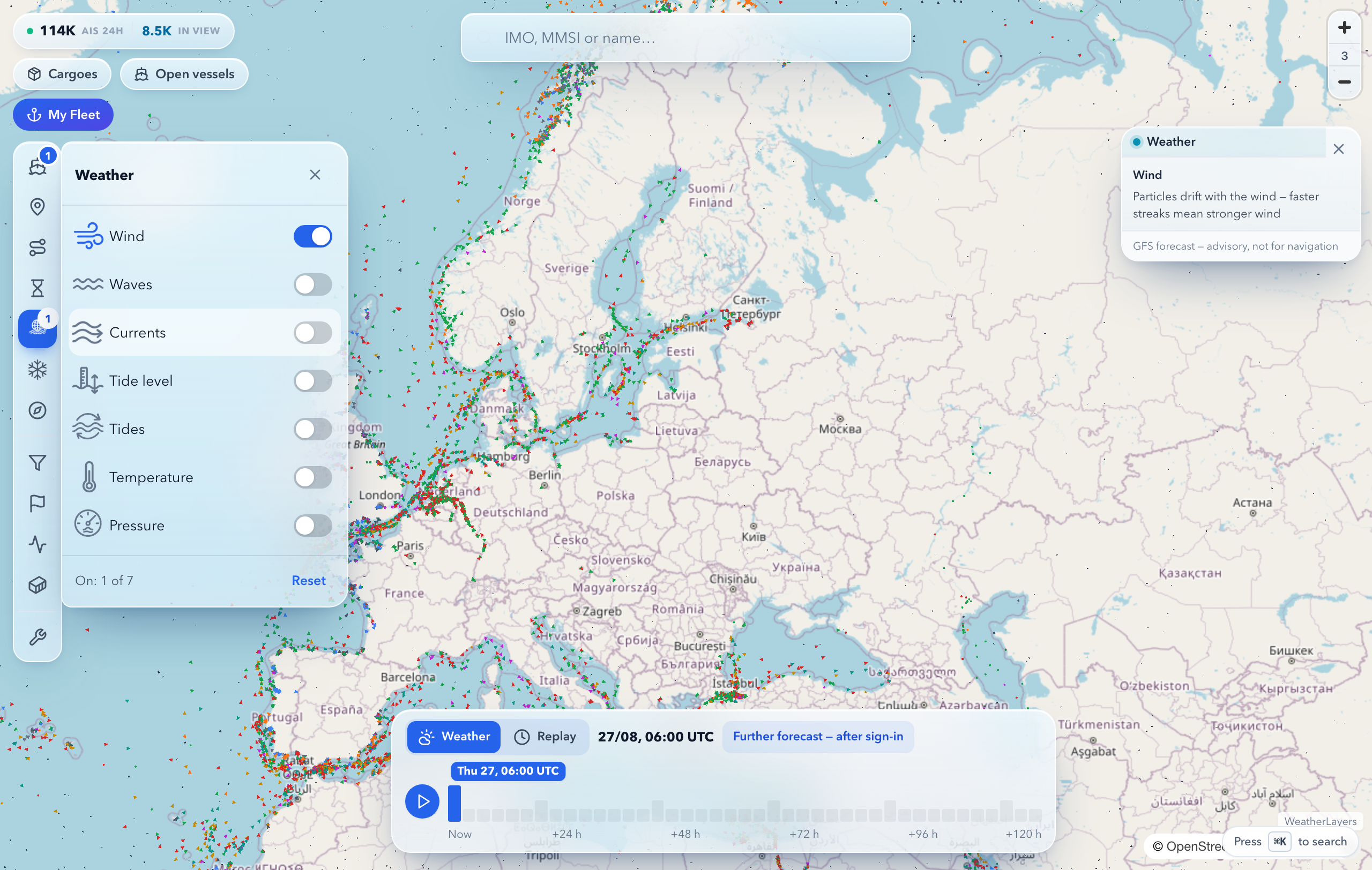
Seven parameters are available:
- Wind — direction and strength are shown as moving particles. The denser and faster the streaks, the stronger the wind.
- Waves — a colour fill of wave height: calm water and large swell are shaded differently.
- Steady currents — moving particles of the persistent circulation; particle colour reflects water temperature from cold to warm.
- Tide level — a colour fill of the water-level deviation: you can see where it is high water and where it is low water right now.
- Tidal currents — arrows with the speed and direction of the tidal stream. The arrows appear as you zoom the map in — at overview scale the legend prompts you to zoom.
- Air temperature — temperature near the surface.
- Pressure — the atmospheric pressure field, which reveals cyclones (areas of low pressure) and anticyclones (high pressure).
Why it is useful
The layer gives a quick, visual overview of the weather across a large area. During planning it helps you choose a window with acceptable conditions, see where bad weather is heading, and compare possible departure times.
How to turn it on and read it
- Open the layers panel on the maritime map.
- Enable the weather layer and choose the parameters you need — they combine: for example, wind on top of the wave fill.
- Move the forecast time scale in the dock at the bottom of the map, or press the play button to the left of the scale — the forecast plays through the hours by itself; press again to pause.
- Click a spot at sea — with the layer on, the cursor over the map becomes a crosshair — and a popup shows the numeric values for that location and hour. With tidal layers on, the popup adds the water level and a tide-calendar button.
Values are shown in marine units:
- wind and current speed — knots (nautical miles per hour), wind additionally on the Beaufort scale (wind force from 0 to 12);
- wave height and water level — metres;
- pressure — hPa (hectopascals);
- temperature — degrees Celsius.
How deep is the forecast
| Plan |
Forecast window |
| Without an account |
the current hour only |
| FREE |
+24 hours |
| PRO |
+120 hours — the full model horizon |
| ENTERPRISE |
+120 hours — the full model horizon |
Scale notches beyond your plan's window are dimmed; clicking them opens an upgrade to the next plan.
Limitations
- This is a forecast, not fact. Real weather may differ from the model, especially in complex coastal and ice-affected areas.
- The forecast horizon is limited by weather models — roughly 10–15 days. The further ahead, the lower the accuracy: the final days are only indicative.
- The layer is for general situational awareness, not for navigation. It does not replace official weather bulletins, storm warnings, or onboard instruments. Base departure and passage decisions on official sources.
See also